
{{ item.name }}
{{ item.category }}

{{ searchResults.msg}}
Help
Navigate on the map using the mouse, zoom buttons on the map window, or pop-up menu commands.
How to do itZoom in / Zoom out: Use the mouse wheel or the  and
and  buttons on the right side of the window. You can also zoom in by double-clicking the map.
Select the map view that is shown in the map window, for example, guide map or air photo.
How to do itClick the Select map view tab  .
.
Show data sets on the map, for example, names of city districts or postal districts.
How to do itThe selected data set is shown on the list at bottom right. There you can hide the data with the  button or change its transparency with the
 ![]() button.
button.
Move to your current location on the map.
How to do itClick the Own location icon ( ) on the right side of the map window.
Measure distances on the map.
How to do itClick the Measure distance icon ( ) on the right side of the map window.
The distance between the given points is shown on the map at the center of each measurement line. Total distance from the starting point is shown next to the mouse pointer all the time and above the last clicked point.
Search for addresses, services and other objects.
How to do itSearch results are shown in the Search results tab of the side bar in alphabetical order. The names of the results are listed, as well as the categories in which each result belongs to. By clicking a search result you can move the map view to the area of the result in question.
If several search results are found very near each other, they can be shown in groups on map, and to see all the objects, you need to zoom in.
Delete search results form the map.
How to do itAlternatively, click ![]() .
.
Search for services and objects, such as schools or libraries.
How to do it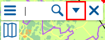
Create a point on the map. You can save the area you have created to My objects, provided that you have created a user name and signed in to the service.
How to do itClick  and select My objects.
Create a line on the map, for example a route. You can save the area you have created to My objects, provided that you have created a user name and signed in to the service.
How to do itClick and select My objects.
Create an area on the map. You can save the area you have created to My objects, provided that you have created a user name and signed in to the service.
How to do itClick and select My objects.
Add the result of a search you have performed to My objects.
How to do itSave the objects you have created as a collection.
How to do itView your collections on the My collections tab.
Give feedback on city services, actions and decision-making, or make initiatives regarding municipal actions.
How to do itEnter the feedback service by clicking the Go to feedback service icon  on the left side of the window.
Create a link to a selected object, point on the map or an area on the map. You can also share the link through social media services.
How to do itClick and select Map link.
Print the view on the map window.
How to do itClick and select Print. The printable view opens in a new dialog.
Sign in to the service to be able to save and view your own collections.
How to do itOn the Current issues tab of the side bar you can view current announcements and notifications regarding city issues.
How to do itClick  on the top right of the window.
Close the announcement by clicking again.
On the eSites tab of the side bar you can apply for free commercial sites.
How to do it
The search results are shown on a separate list and by clicking a result you can see additional information about the plot.